
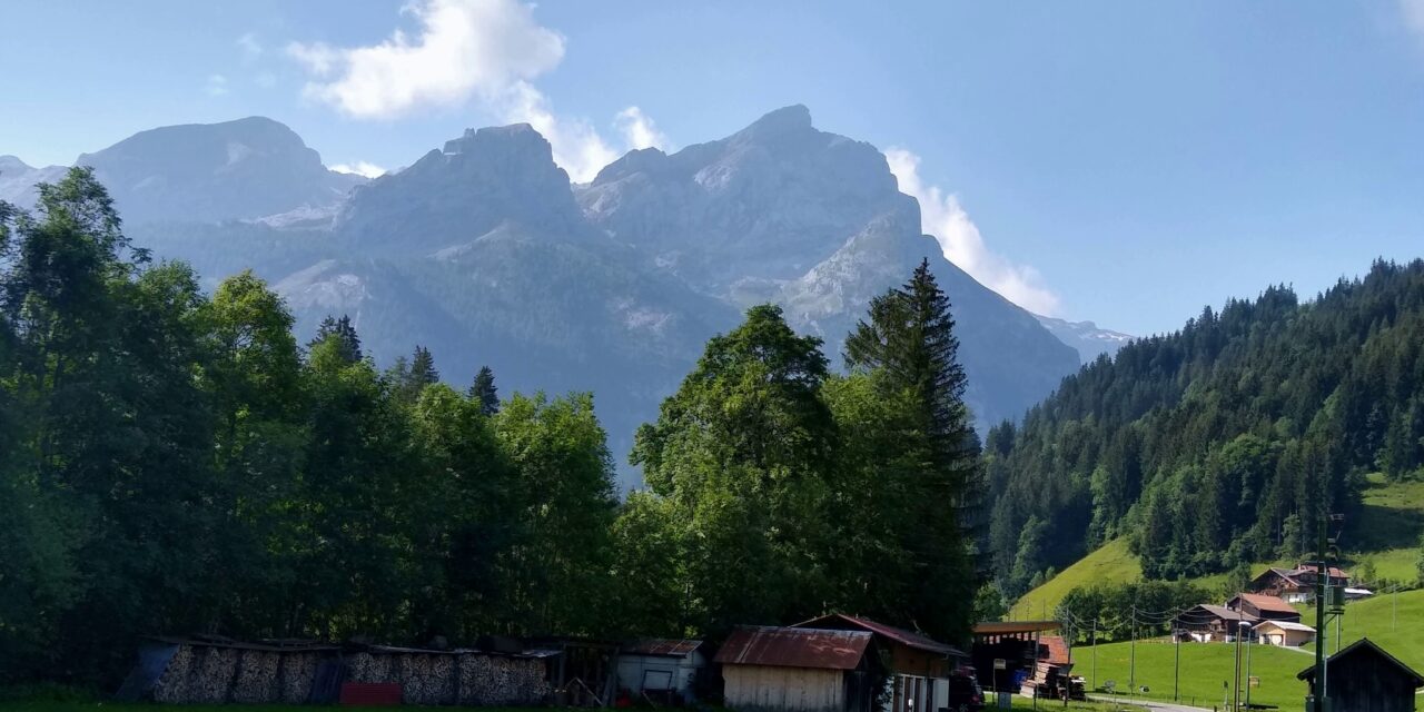
En route to Gestig from Gstaad
Slept really well and felt refreshed and ready for day 2. Breakfast was really good, fresh water melon which was very refreshing. Not sure what our plans for lunch would be so we took a couple of eggs and and orange to go with our dried fruit and nuts with the idea that we would have a proper lunch somewhere en route. Well we had 2 cake stops! No proper lunch as our nibbles worked well.
The ride down from our hotel, into Gstaad and then along minor roads towards Gsteig was very pleasant, a mix of country lanes passing rolling pastureland and small farms. Some of the route early on was on a cycle path and by the time we rejoined the main road the morning traffic had largely dissipated. We stopped in Gsteig to try and figure out which mountains were whcih on the skyline and where the Arpelistock was. Essentially our ride took us along a valley with the mountain range of Les Diablerets to the Wildhorn on our left shoulder. This formed part of an early ski tour that we did some years back with Rick, Tim and Julia. One I would like to revisit in the future. So it was good to be looking up at the mountains even though it was hard to figure out which were which.
See below a screen show of our photos from the ride
Lovely view of the town of Gsteig as we approached, Mike took a small detor into the fields so I could get a good photo. Stopped and chatted to a friendly group of ladies for a few minutes before we could not put the climb off any longer. The climb from Gsteig to the Col du Pillon is 425m over 7km with an average 6% grade. However with some downhill sections and flat sections there were also several stints that were much steeper. Just before the summit there is a real kicker with an average grade of 12% over 300m. No wonder we found it hard work and had a few rests on the way up. A very well earned coffee and slice of myrtleberry tart (to share) at the summit cafe went down a treat. Interestingly Mike and I noticed that we saw no other riders on mountain bikes or carrying panniers on our ride today!
From the summit it was a good ride down to Les Diablerets, a very pretty town which would be nice to visit in Winter. Only challenge is that what goes down (400m) has to go back up again. This time 650m with an average (per the helpful but slightly demoralising sign) of 11%. I think the signwriters got it wrong as my bike computer showed us averaging most of the way at 8 – 9 %. Looking later at the maps on Ride with GPX I saw the avg grade was 8% over 8km. Anyway I was very glad that we had:
- Some shade.
- Spectacular views across the north faces of the mountain range from which we look across to from our apartment.
- A rest about a third of the way up on a grassy back where we had our orange and looked down on to Les Diablerets.
- Another rest about two thirds up at a lovely shady picnic spot (with benches) to eat our very welcome boiled eggs and dried nuts.
- Mike saw a truck coming over the pass road in the distance so we were able to make out where we were aiming for – that gave me a renewed burst of energy.
- I was able to cool down and douse my head in a mountain stream just before the summit.
The top was fun, a small cafe; the obligatory pass sign, a funky wooden bicycle, and an artistic installation of 3 wolves in ‘driftwood’. Anyway we decided not to stop at the cafe as I had set my mind one one recommended by the Cyclist magazine which gave us inspiration for this ride.
Unfortunately the clouds had started to build and so we did not get great views of the mountain ranges on our descent and what views we had disappeared as we entered into a cloud bank – cold even with all my layers on. Seemed like we had been descending for ages but it was only 8km as we reached Villars. Some roadworks gave us the opportunity to get off our bikes and walk a section which was nice as we passed a number of information boards providing details of children at school in the post war years. Great to look at. Warmed up a bit.
We think that Villars marks the start point for climbing the Col and a number of people will get public transport (trams) from Bex on the valley floor up to here. Anyway it is where the Strava challenge starts from. I must admit that I would not want to cycle from Bex to Villars. There are long sections where the tram lines are on the uphill road side, also there were some very steep and narrow sections after this point. Our planned cafe stop was only 3km away and a very good stop it made. Not only did we indulge in cakes but with our coffee we were served small chocolate and cream indulgences! Felt a bit deserted out after 2 coffees!
The ride down from here back to the car was much warmer as we moved out of the cloud. We went by tiny villages perched on the mountainside, passed terraced vineyards and saw the entrance to the salt mines for which Bex is famous. Lovely pastoral scenery that is typical in the Valais but I never get tired of it.
The car was still where we parked it. Always a relief. Didn’t feel like cooking so we finished off a perfect, but challenging tour, with a pizza at Tcin Tcin.
The tour was less dramatic in parts than the one we did last week, the passes were lower, there was less traffic except for the start of our climb on the first day, it was lovely to ride through rolling high pastures. Would do this again.
See below for a map of our route


